Sunday, April 22, 2012

New Buddha Religeon Section (4/21)

I did a project to setup a separate area on my web site dedicated to the Buddha religeon. This is separate from the main pages on my site, and has been placed there as a special religeous project for some voluntary work I have been doing for a local Buddha temple.


This new and special area on this web site can be seen by clicking the link for it below.

http://www.sky-chaser.com/audiobook/index.htm

Tornado Outbreak Chase (4/14)

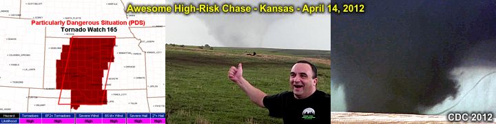
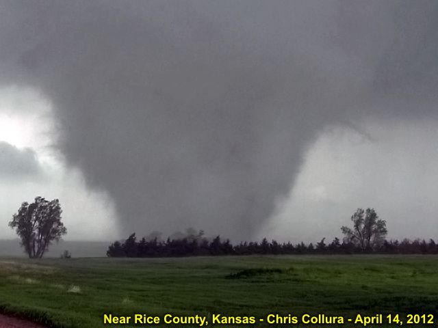
I have completed a storm chasing trip in the Central USA (Kasnas) from April 13-15, 2012 with numerous tornadoes intercepted on Saturday, April 14, 2012 in Kansas. This setup was a high-risk setup, with deadly tornadoes affecting this area, and a tornado outbreak occurred. In this chase trip, the entire lifecycle of a violent tornado was observed and documented on Saturday, April 14 near Geneseo in Rice County, Kansas - Rated EF-4 and being on the ground for almost an hour.


I have finally completed a full-chase log for this event, and it can be viewed in my on-going section for storm chasing in 2012 that can be seen by clicking the link that is provided below.

http://www.sky-chaser.com/mwcl2012.htm


For a documentary video of the April 14, 2011 extreme storm chasing in Kansas, click the link below!

http://www.sky-chaser.com/m13vid1.htm

Thursday, April 19, 2012

Weekend Chase Planned (4/13)

Storm chasing is heating up and a MAJOR severe weather setup appears to be on tap for the weekend (especially Saturday, April 14) in the central USA. I was able to get tickets and will be flying out on Friday the 13th of April, chase Saturday (the 14th in Kansas), and return on Sunday the 15th!


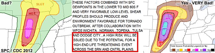
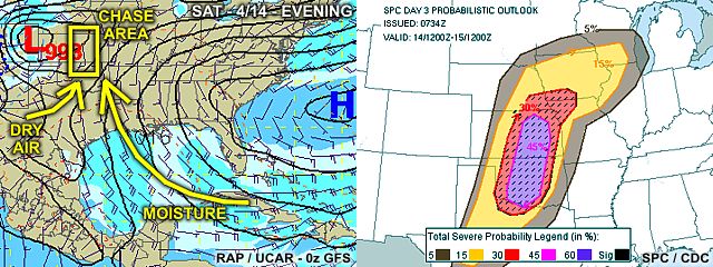
In the image above, a moderate risk (later upgraded to high) was in place as per the Storm Prediction Center (SPC) on Thursday, April 12.


In the above image, issued by SPC on Friday, April 13 (for Saturday the 14th), a rather scary hish-risk (with 60% hatched probabilities) outlook and chilling text was published as a "high-end life threatening event"! A full-chase log for this event will be available (in my on-going section for storm chasing in 2012) once this first major chase is completed, and that area can be seen by clicking the link that is provided below.

http://www.sky-chaser.com/mwcl2012.htm

Sunday, March 18, 2012

Spring Break Trumps Chasing (3/18)

During a rather active start to the storm chasing season of 2012 ... A rather frustrating and down right agonizing scenario unfolds to a storm chaser stuck in the "corners" of the country. No, it's NOT because of work, school, family, or what not - But for folks living in the middle of the USA - Read no further (this does NOT apply to you).


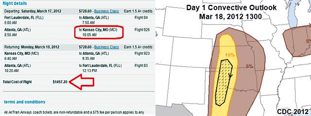
In the images above, to the right we see a nice setup example (March 18) unfolding across some favorable and fun storm chasing terrain, and on a WEEKEND to boot. The problem NOT visible here is the TIME of the year - SPRING BREAK. Take a look to the left image ... Yes, nearly $1,500 to fly from Fort Lauderdale to Kansas City - Yes, that's REAL. Most other airlines simply don't even HAVE any seats left.

Any my free tickets on SW - Out of the question, they were smart enough to back those out this weekend. This is WHY I normally do not chase storms before mid April. Aside the linear and fast-moving nature of storms and setups, chasing before late April is just impossible if you are not within driving distance of the central USA.

Monday, March 05, 2012

Bad Start For March (3/2)

The beginning of March 2012 was marked by a very tragic and unfortunate tornado outbreak on Friday, March 2. An outbreak of tornadoes, some violent, occurred during the afternoon on March 2 across Alabama, Indiana, and Kentucky. As of March 5, the death toll stands at 39 people, including a 15 month old baby who died a few days later in the hospital after being carried 10 miles by a tornado after both her parents were killed. This is a very sad and unfortunate severe weather event.


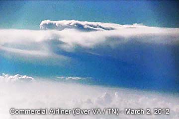
In the image above, taken from a Boeing 737 aircraft flying at an altitude of about 39,000 feet, the distant but ominous supercell storm can be seen prominently looming over the 40,000 foot cirrus deck and extending high into the stratosphere. The flight path was over TN / VA at the time, with the view in the picture westward towards I-64. Right about the same time of this subtle image was taken, tornadoes "under" that same cloud were already killing people.

Friday, March 02, 2012

"Cut To The Chase" DVD (3/1)

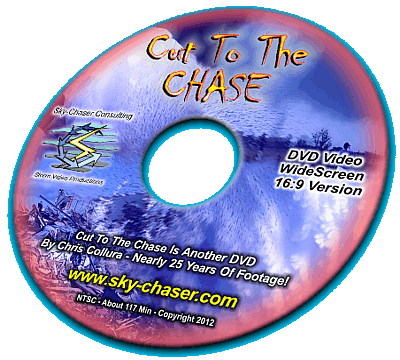
This is a career-long compilation of some of the most intense moments of storm chasing with footage as far back as 1987 (almost 25 YEARS of storm chasing). The most boring parts have been edited out and this DVD has almost two hours of non-stop high-action video! See every form of extreme weather, from thunderstorms and flooding to hurricanes, tornadoes, and even blizzards! See some of the gripping footage from hurricane chasing projects, including the violent hurricane seasons of 2004 and 2005.


See tornadoes intercepted in just about every corner of the Central US, as well as their devastating aftermath. This DVD just about has it all - And then some! For more information and how to order this DVD, click the image above or the link provided for it BELOW.

http://www.sky-chaser.com/offers13.htm

This is NOT all that is available in my DVD collections for sale ... Be sure to check out the latest DVD production above, as well as many others by visiting my special "offers" page for video documentaries at the link provided BELOW as well.

http://www.sky-chaser.com/offers.htm

ChaserCon 2012 (2/19)

I attended the National Storm Chaser Convention (also known as "ChaserCon") in Denver, Colorado from February 17-19, 2012 ... This continued to be another fantastic yearly event that brought in storm chasers from all over the US (and beyond) to collaborate in a three-day event in the mile-high city. Having everyone together and the way Roger Hill and Tim Samaras ran the operation was an experience second to none.


What an awesome job, from Andy Gabrielson's touching tribute to video night and spotter training, and over 350 attendees to make it all the better. Imagine having dinner with keynote speaker Sean Casey (IMAX film-maker and inventor of the TIV), seeing Tim Marshall's fantastic presentations, and Howie Bluestein just to name a few ... That's what ChaserCon does - Brings us all together to enjoy our passions!

You can also jump right to the area for storm chasing events in 2012, including the storm chaser convention, by clicking the link provided for it below ...

http://www.sky-chaser.com/picnic12.htm

For official information on this event, you can also visit their site at the link below (link may be time sensitive / subject to change without notice) ...

http://www.ChaserCon.com

2012 Everglades Boogie (1/28)

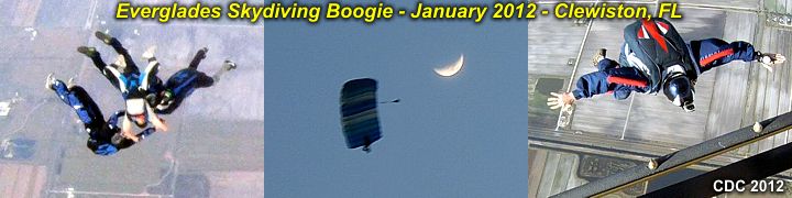
Each year, Skydive Air Adventures outside of Clewiston, Florida (at Airglades airport) hosts the "Boogie over the Everglades" skydiving event on the last weekend of January. This yearly "boogie" (what skydivers call a "special event") draws a crowd of hundreds from many areas of the United States (and some other countries as well) and has everything from specialty jumps (such as high-altitude or jumps from a helicopter) to skydives from multiple aircraft (Skyvan, DH6 Otter, and A-90 King Air) plus a big party with free beer each night of the 3+ day event.


Air Adventures skydiving continues to make this a well-anticipated and well done event year after year. Weather, although predicted to be bad, turned out to be fantastic as well - For pictures / video of this exciting event, please visit my SKYDIVING section of my web site. You can also jump right to the link by clicking link provided below ...

http://www.sky-chaser.com/skydive.htm

Happy New Year 2012 (1/1)

Wishing everyone a happy and safe New Year for 2012 ... Hopefully this year will be another great year for storm chasing and outdoor activities - But hopefully without the horiffic loss of life and property damage we saw in 2011.

Hurricane Season Ends (11/30)

The Atlantic hurricane season runs from June 1 to November 30. Oficially, the 2011 hurricane season is over. To re-cap, the 2011 season was pretty busy, but the only real disastrous storm (affecting land) was Hurricane Irene in late August 2011 (chase log is BELOW for Irene).

http://www.sky-chaser.com/irene11.htm


The rest of the season was burdened by tropical cyclones that were either highly-sheared and / or remained out to sea. All in all, a total of eighteen (18) named storms developed, six (6) of which became hurricanes (three (3) of the hurricanes were major hurricanes). Only one hurricane was intercepted in 2011, that being hurricane Irene. Some other chasers chased hurricane Jova on Mexico's west coast (near Manzanillo) this year as well.

Hurricane Rina (in late October 2011) was another awesome candidate for a chase in Mexico, I actually had tickets booked and all, but the shear ripped Rina apart, and the chase was called off within mere hours of going. The storm was forecasted to hit Mexico during the mid-day hours near Playa Del Carmen / Cozumel as a 120 MPH+ storm, but the shear did not relax, and she came in at night as a 45 MPH dissipating cyclone.


Meanwhile, 2011 lived up to its name as the "year of the tornado" on Nov 7, 2011 in Oklahoma with a late season supercell producing at least six tornadoes some of my fellow chase partners intercepted - Again, the "shear" that never relaxed! For tornadoes in 2011, see the link BELOW as well!

http://www.sky-chaser.com/mwcl2011.htm

Wednesday, November 16, 2011

S Florida EF-2 Tornado (10/18)

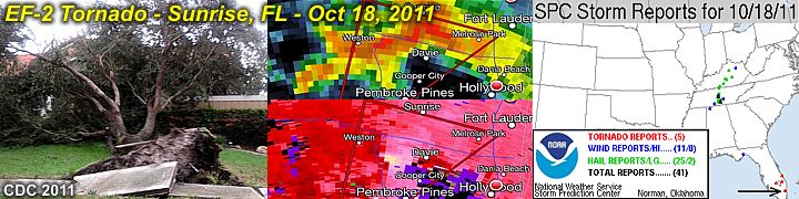
An EF-2 tornado affected Sunrise, Florida in Broward County on October 18, 2011 during the late evening - I was chasing this storm and encountered the tornado (barely visible by lightning and power-flashes)!


The storm was a classic supercell that originated over the rural areas of western Miami-Dade county (south of Miccosukee in the Florida Everglades) and moved north and northeast over a two to three hour period through the western sections of Broward and eventually southern Palm Beach counties (where it weakened). The storm produced a destructive tornado, with winds at least 120 MPH (EF-2), from Plantation to Sunrise, just north of I-595 and east of NW 136 avenue.

The tornado was about 150 yards wide, and had a damage path, oriented SSW to NNE, over a mile in length. Some information on this chase can be seen in the STORM CHASING section of this web site (in the "PICTURE Log For 2010 And After Chases" section) or you can go right to that area by clicking the link that is provided below.

http://www.sky-chaser.com/stplog4.htm

Sunday, September 11, 2011

Remembering Sept 11 (9/11)

September 11, 2001 was one of the darkest days in American history. It has been exactly ten (10) years since that fateful day. This year (and every year) is a good time to remember those who lost their lives because of a hostile and down-right cowardly act of terrorism inflicted on the United States by the Al Qaeda / Taliban groups.


Who can forget the heroes that fateful day? To skip to more details on September 11, 2001 and many other subjects about the US, click the link that is provided below.

http://www.sky-chaser.com/america.htm

US Tropical "Protection"? (9/7)

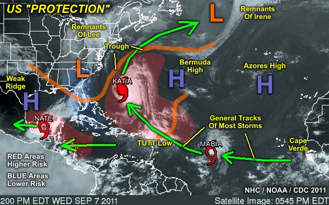
The tropics are very busy as of September 7 ... However, little or no threats exist for the US anytime soon! As of September 7-9, hurricane Katia and tropical storm Maria are churning in the open tropical Atlantic, and NOT expected to affect any land. Tropical storm Nate has formed in the Bay of Campeche, and expected to move into Mainland Mexico later this week. As I mentioned, VERY busy Atlantic tropics, but no threat to the USA at this time.


The graphic above shows the general weather pattern during the week of September 7, 2011. Note (in the graphic above) that despite quite a bit of activity in the Atlantic, the combination of a persistent trough off the US East coast as well as weak high-pressure ridging in the southern Gulf of Mexico, the southeastern and eastern US / northern Gulf regions are sort of in a "quiet zone" (blue area) and nestled in between regions of above-normal risk for tropical cyclones (red areas).

Hurricane Irene (8/28)

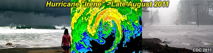
My interception and hurricane chase for hurricane "Irene" was on August 26-28 in North Carolina after a coastal observation of its effects in South Florida on the 25th.


Hurricane Irene caused over 10 billion dollars in damages and at least 55 deaths, especially in the mid-atlantic region of the United States. A full chase log and write-up is completed and has been posted in the STORM CHASING section of my web site.

You can go right to the link for the chase log by clicking the link that is provided below.

http://www.sky-chaser.com/irene11.htm

South FL Tornado (8/2)

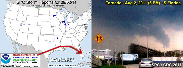
A small tornado in its late stages was caught on camera late in the afternoon of August 2, 2011 from a 5-10 mile distance. In the image below, the distinct funnel stretched along the gust front can be seen just before the tornado dissipated.


Damage was to some homes (roof torn off) with winds near 90 MPH (EF-1). The view is to the north from near Fort Lauderdale Airport as the storm was weakening and just before the tornado lifted.

Wednesday, July 06, 2011

Tropical Storm Arlene (6/30)

With the main part of the the devastating 2011 tornado season behind us, the focus turns to the Atlantic hurricane season that runs from June 1 through November 30.


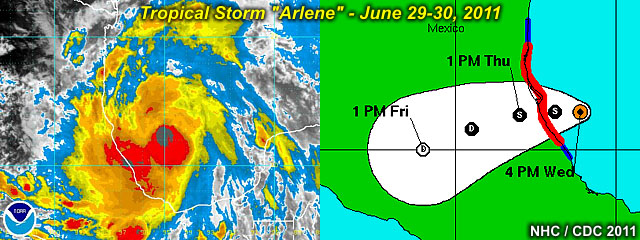
Tropical storm "Arlene" was the first named storm of the 2011 Atlantic hurricane season, forming in the Bay of Campeche (SW Gulf of Mexico) on June 28-29 and moving into Mexico as a strong tropical storm on June 30.

Be sure to keep up-to-date with both tropical activity and hurricane chasing operations by checking back here often. I have a page showing tropical activity that can be seen by clicking the link that is provided below.

http://www.sky-chaser.com/tropics.htm

Monday, June 06, 2011

Tornado Alley Terror (5/31)

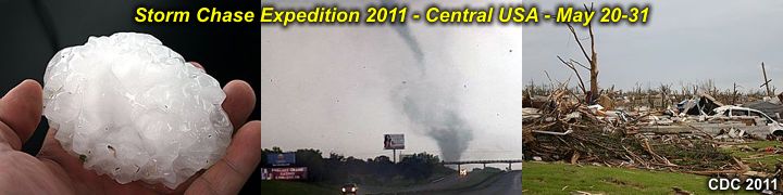
Once again, a major chase trip / expedition has been wrapped up and completed for the central USA from May 20 through May 31, 2011. I have finalized a detailed chase log for this trip.


Unfortunately, this heightened activity came at a very hefty price, especially with a devastating EF-5 tornado in Joplin, Missouri on May 22. These updates can be seen in my STORM CHASING section for MIDWEST 2011 on my web site. You can also go right to that area by clicking the link that is provided below.

http://www.sky-chaser.com/mwcl2011.htm

For a documentary video of the May 20-31 trip storm chasing in the central USA, click the link below!

http://www.sky-chaser.com/m12vid2.htm

Walking On Clouds (5/16)

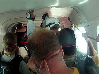
The image below shows a bunch of skydivers just about to exit a Cessna Caravan 13,500 feet over Clewiston, FL. What's so interesting about the picture? The plane is in a zero-G maneuver (Hint: the guy in the upper-left floating to the ceiling)!


Skydiving is an awesome sport allowing man to become "superman" with only you and gravity being the driving forces once outside of the airplane! See my collection of skydiving pictures and videos in my SKYDIVING section of this web site). Click the link below to see my section on skydiving.

http://www.sky-chaser.com/skydive.htm

You can also click the link below for a cool video of a jump over Clewiston, Florida, buzzing past clouds with my new Saffire 150 canopy and Javelin container!

http://www.sky-chaser.com/skygpv6.htm

Saturday, May 07, 2011

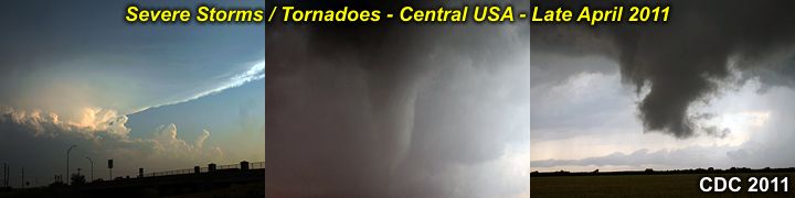
April 2011 Record Tornadoes (4/29)

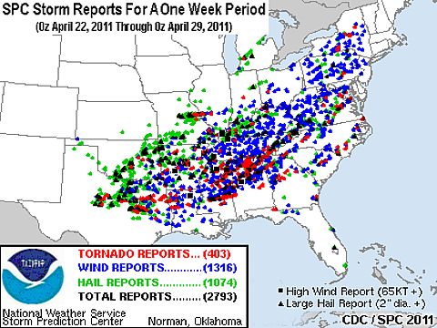
April 2011 went down as the busiest April in history for the sheer number of tornadoes in the United States for that month. The last week in April 2011 also brought one of the deadliest and devastating tornado / severe weather outbreaks in US history. The below diagram is a composite of all the storm reports during a mere one-week period from April 22nd through the 29th. A total of 2,793 severe storm reports were posted by the Storm Prediction Center (SPC) with a staggering 403 tornadoes (red dots), 1,074 hail reports (green dots if 1" or more and black triangles if over 2"), and 1,316 high wind reports (blue dot if 58 MPH or more, black square if 74 MPH or more)!


Unfortunately, this event took a heavy toll on human life and property, including around 300 people killed. The intercept done on April 24, 2011 by myself (see the STORM CHASING section of this web site for details) in Texas was the START of this horrific outbreak. May God be with the families and people affected by this recent disaster.

For my April 24, 2011 chase (also in my STORM CHASING section of my web site), please click the link below to go right to it...

http://www.sky-chaser.com/mwcl2011.htm

First 2011 Central USA Chase (4/24)

Storm chase season 2011 has BEGUN ... So check back often to see my storm chasing plans for 2011. I have finished a short chase trip to Texas as of late April (with the main chase April 24, one chase day out of an extremely active tornado pattern for April of this year).


This first April (weekend) chase yielded at least three tornadoes near Baird and Abilene, Texas ... Hopefully the start of a fantastic chase year. Storm chase 2011 was AMAZONG ... So check my section for storm chasing in 2011 that can be seen by clicking the link that is provided below.

http://www.sky-chaser.com/mwcl2011.htm

For a documentary video of the April 24, 2011 trip storm chasing in Texas, click the link below!

http://www.sky-chaser.com/m12vid1.htm

Thursday, March 24, 2011

Saint Patrick's Day (3/17)

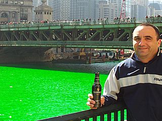
Happy Saint Patrick's Day to all (March 17) ... Ever wonder what Chicago, Illinois does on Saint Patrick's day? They dye there river a bright GREEN to celebrate!


See these events and much more in my OUTDOORS section of my web site, or jump right to that section by clicking the link for it below...

http://www.sky-chaser.com/outdoors.htm

Japan Earthquake & Tsunami (3/11)

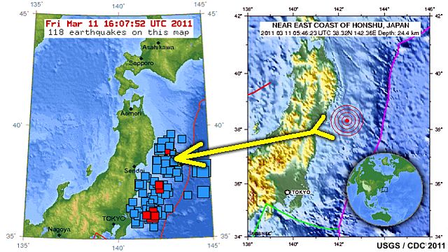
What is today's world coming to - 2012 (for real)? A massive (yes another) earthquake series (the strongest one officially measuring at a staggering 9.0) rattled central Japan (near Honshu) on March 10-11.

Since the earthquake was offshore, it also generated a destructive tsumami that struck the Japanese coast only 10 minutes after the offshore quake. The tsunami also propogated across much of the Pacific ocean with the speed of a jet airliner, affecting many islands (including Hawaii) and eventually the west coasts of North and South America.


The quake and tsunami caused MANY thousands of deaths and even a nuclear disaster as well. Some disturbing video of the Japan Tsumami can be seen by clicking the link below ... Note: video is courtesy of Russia Today media and is an external link to YouTube and might be time-sensitive.

http://www.youtube.com/watch?v=zY2HPT7obWE

It's Still Winter Up North (3/5)

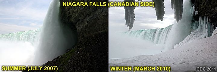
Despite it being quite warm down here in Florida and the south, winter is still in full force in the northern part of the country / Canada.


In the images above, the differences in Horseshoe Falls in Canada can be seen between summer (left) and winter (right). See more winter weather photography and subjects in my WINTER section of my web site. You can also check out the link for it below ...

http://www.sky-chaser.com/winter.htm

Tuesday, February 22, 2011

Site Video Upgrades (2/22)

Most of the videos for this site has been re-done and upgraded via links to YouTube for a MUCH better resolution and claraity. Basically, the video sections on this site work the same, but should be much better in quality. You still should see an embedded video on the screen. If some video links do not work, please let me know.


The video hosting is on YouTube to releive some load off this site, and offer a far greater resolution than the less-compatible (former) RealMedia format. If you want to jump directly to my channel on YouTube, you can follow the link provided below ...

http://www.YouTube.com/cdcollura

ChaserCon 2011 (2/20)

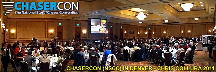
The National Storm Chaser Convention, or "ChaserCon", takes place in mid-late February each year in the Denver, Colorado area. I attended the convention this year for February 18-20, 2011. This exciting event offers a large storm chaser and scientific collaberation with guest speakers, presentations, vendor area, banquet dinner, and video presentation night. Over 300 storm chasers showed up at this event.


You can also jump right to the area for storm chasing events in 2011, including the storm chaser convention, by clicking the link provided for it below ...

http://www.sky-chaser.com/picnic11.htm

For official information on this event, you can also visit their site at the link below ...

http://www.ChaserCon.com

Monday, January 31, 2011

2011 Everglades Boogie (1/30)

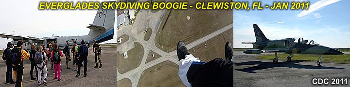
The annual 2011 Everglades Skydiving Boogie took place during the weekend of January 28-30 in Clewiston, Florida. This boogie continues to be a fantastic skydiving event, with multiple aircraft (including a helicopter and "specialty" aircraft), the rare opportunity to ride in an L-39 fighter jet, and a great crowd of skydivers to boot!


Year after year, it continues to be an awesome event, put together by the great folks at Air Adventures! You can check out this event, along with many others, in my SKYDIVING section of my web site. You can also jump right to the link by clicking link provided below ...

http://www.sky-chaser.com/skydive.htm

Wednesday, January 26, 2011

FL Tornadic Supercell (1/25)

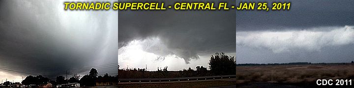
The first major chase of 2011 was on January 25, 2011 with the interception of a tornadic supercell storm to the south of Sebring, FL in Highlands County. The storm was developing ahead of a squall line of severe storms and quite possibly produced the first tornado to be observed in 2011!


I have pictures posted in my local chase log in the STORM CHASING section of my site, and you can click the link provided for it below to jump right to that section.

http://www.sky-chaser.com/stplog4.htm

Monday, December 27, 2010

Aero Engines Section Added (12/26)

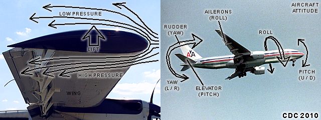
I have put together an interesting section on aircraft flight and propulsion principles. It is valuable for any aviation enthusiast, especially students, and has diagrams and illustrations for reference purposes.


I added this to my section on FLYING as an additional link off that page, as well as my main site page. You can also click the link below to jump right to this new section.

http://www.sky-chaser.com/aeroeng.htm

Lunar Eclipse (12/21)

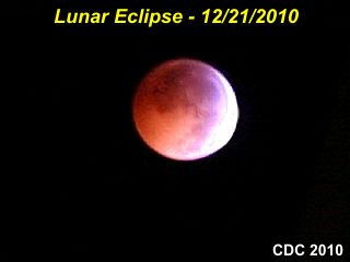
There was a Lunar eclipse during the overnight hours of December 20-21, 2010 (late night / early morning). In south Florida, the eclipse lasted from roughly 2:30 AM through 3:30 AM EST. Clear and cool conditions made for perfect viewing of the event, where the Earth's shadow is cast on the sun-lit face of the Moon (the opposite of a solar eclipse, where the Moon's shadow is cast on the earth).


Click the link below to see a short video of the event (links to YouTube videos) that has been posted. The video is about 3 minutes.

www.sky-chaser.com/lunevid1.htm

New 2010 Chase DVD (12/1)

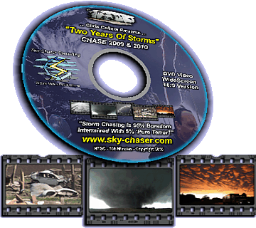
See storm chasing highlights from 2009 AND 2010 in "TWO YEARS OF STORMS" DVD! Nearly two hours of compelling footage starts with two chases in 2009, including June 5th in Nebraska and Wyoming. In 2010 see the devastation and emergency response in Yazoo City, Mississippi, just minutes after a violent tornado struck the town.

Awe at the beautiful storm structure across the Central USA in May 2010. See a mile-wide violent tornado grinding its way across the farmland north of Bowdle, South Dakota, plus many other storms and tornadoes. See Pike's peak in Colorado at over 14,000 feet above sea level, then it's off to Bermuda to chase Hurricane Igor!


For more information and how to order this DVD, please check out the special OFFERS section of my web site, and you can click the link provided for it below to jump right to that section.

http://www.sky-chaser.com/offers12.htm

Wednesday, November 17, 2010

Hurricane Season Ends (11/30)

The Atlantic hurricane season ended on November 30, 2010. Despite it being the third busiest season in history, NO hurricanes made landfall in the United States. Actually, only weak tropical storms, including Bonnie ever affected the US mainland directly. Anything even worth chasing in the USA was the northern fringes of hurricane Alex (extreme southern Texas in late June), tropical storm Bonnie (near Miami, Florida in late July), and the weak western fringes of hurricane Earl (outer banks of North Carolina in early September).


Major international chases were a bit better, and included hurricanes Alex and Karl in Mexico and hurricane Igor near Bermuda. Other than that, MOST major activity stayed in the far eastern Atlantic with storms recurving out to sea long before reaching any land. My hurricane chasing / tropical weather section is updated each year and is in my STORM CHASING section of my web site, and you can click the link provided for it below to jump right to that section.

http://www.sky-chaser.com/stormc.htm

California For 2-Weeks (11/15)

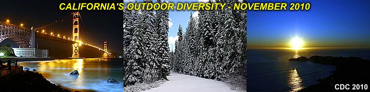
I just got back from a two week trip to California visiting best friends of mine and enjoying the never-ending outdoor and scenic activities to be had there. I covered all scenic aspects of the state, from Los Angeles to San Francisco, from down to the sea and up to the mountains! If you love the great outdoors, California is the place for you ... Heck, I did so much hiking and outdoor stuff I still lost 10-15 LBs despite drinking lots of wine and eating more!


I posted many pictures in my OUTDOORS section of this web site, and you can click the link provided for it below to jump right to that section.

http://www.sky-chaser.com/outdoors.htm

Skydive From 18,000+ Ft (11/13)

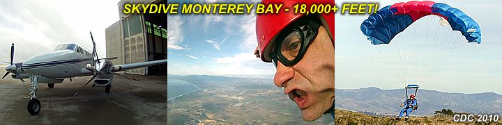
One of the extreme activities I did during my 2-week stay in California was a visit to the Skydive Monterey Bay drop zone. They take jumpers to at least 18,000 feet (supplemental oxygen is available) on many skydives and I have a video of two of them I did.


You can see video of this skydive by clicking the link for that area on my web site provided below.

http://www.sky-chaser.com/skygpv3.htm

Storm Chase Vehicles (10/25)

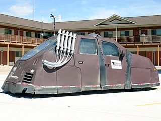
You have seen them on the Discovery Channel and may have seen them on the road while chasing in tornado alley. Myself being a storm chaser, I see them nearly every day when I am chasing during tornado / hurricane season. These are the storm chase vehicles, and they range from privately owned cars, to exotic scientific machines, and even aircraft.


Check out this special new section in my STORM CHASING part of this web site, or click the link for that area on my web site provided below.

http://www.sky-chaser.com/chasev.htm

Wow - Typhoon "Megi" (10/17)

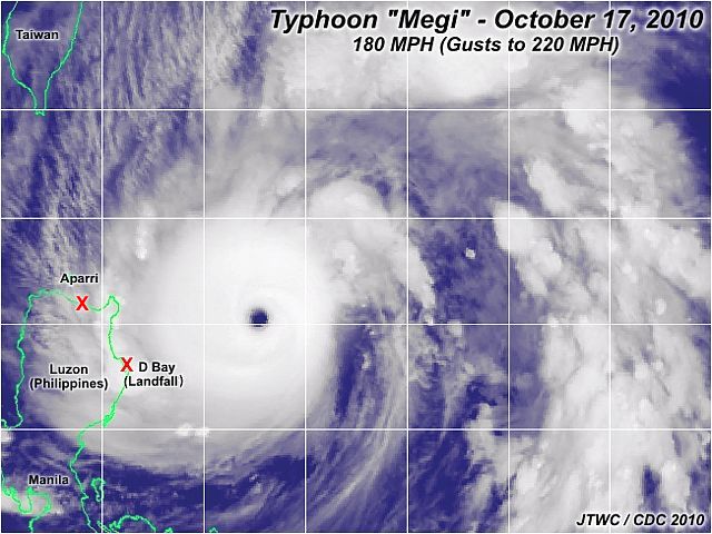
The true violence of a tropical cyclone at maximum intensity is a sight to behold when typhoon "Megi" affected the Phillipines and China a half a world away from the US in the western Pacific basin in mid October 2010. Typhoons are the same systems as hurricanes, just the name if different in that part of the world.


In the image above, typhoon "Megi" reaches maximum intensity as it bears down on the NE coast of the Philippines (Luzon), with insane core winds exceeding 180 MPH with higher gusts. Chasing something like this is like driving into an EF-5 tornado that's 40 miles wide! A handful of chasers intercepted the storm, including James Reynolds (Hong Kong) and Geoff Mackley (Australia). Fortunatly, the landfall area near Davilican Bay was rural and mountainous. This made it hard for any intercepts of the typhoon core there.

Hurricane Paule (10/14)

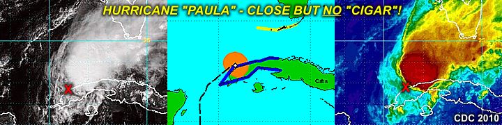
The "good luck" streak for a non-hurricane landfall in 2010 continues with a very small hurricane Paula weaking to a tropical storm over western Cuba around October 14, 2010. Although "good luck" for most people in the USA, this is very "bad luck" for storm chasers seeking hurricanes to intercept. Paula seemed to be a rather promising prospect as the W Carribbean / Gulf of Mexico is normally active in October. Paula was a very small storm with a core flow barely 50 miles wide, even at maximum intensity when it had 100-MPH winds (the hurricane forced winds barely exceeded 15 miles from the center).


In the images above, note that the storm center (depicted by the red "X" in the satellite images) is on the SW side of the central overcast as strong vertical wind shear / mid-level dry air causes Paula to weaken rapidly over western Cuba.

Skydiving Past Clouds Video (10/2)

Here is another video of a skydive I made using the GoPro "Hero" HD camera. This video shows what it's like to fall through / past a cloud deck (altocumulus undulatus) at speed.


You can see video of this skydive by clicking the link for that area on my web site provided below.

http://www.sky-chaser.com/skygpv2.htm

Monday, September 27, 2010

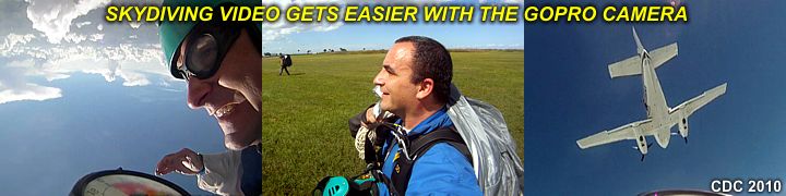
Skydiving HD Video (9/26)

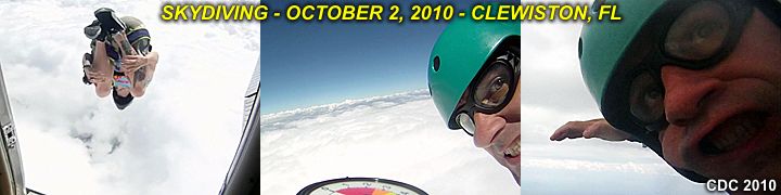
With last week's chase of hurricane "Igor" in Bermuda, my new GoPro "Hero" HD camera was indispensible for getting some of the amazing shots. With such a rugged waterproof and stable enclosure, it can be mounted just about anywhere. This time I did one of my "regular" skydives with this tiny tapeless camera affixed to my left wrist. The HD video it captured was awesome, and all extreme sports (skydiving included) are taking advantage of this.


The images above were captured during one of my skydives with the camera on my wrist, offering a unique perspective. You can see video of this skydive by clicking the link for that area on my web site provided below.

http://www.sky-chaser.com/skygpv1.htm

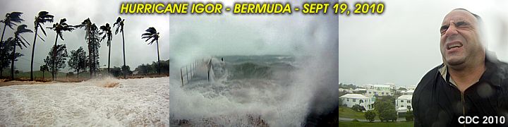
Hurricane Igor Chase (9/21)

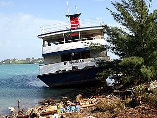
I am finished with a pretty successful hurricane Igor interception in the tiny island of Bermuda. The hurricane chase was from Saturday, September 19 through Tuesday, September 21, 2010. I am back in Florida in the United States and I have prepared a chase-log for the storm.


You can see my intercept of hurricane Igor (my chase log for it) by clicking the link for that area on my web site provided below.

http://www.sky-chaser.com/igor10.htm

Hurricanes 2010 (9/15)

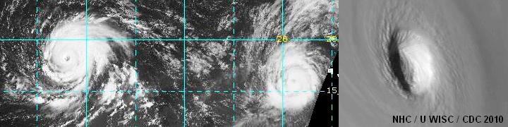
The Atlantic hurricane season of 2010 has been a very active season so far (as of mid September 2010); however, none of the most violent storms have affected land. The above-normal sea surface temperature anomaly in the far eastern Atlantic is producing more hurricanes, but fortunately the development so-far-out east is actually causing the Eastern US to be spared, with hurricane Earl being the closest shave of one of these missing-the-US storms.


In the image above, two powerful hurricanes (Igor and Julia) are raging in the far tropical Atlantic, far from any land. The image to the right is a close-up of the eye of Hurricane Igor at maximum intensity on September 13. None of these storms were affecting anyone at this time; with fish, birds, and whales most likely the only "beings" experiencing the fury of these hurricanes! Even ships do not travel through that part of the ocean very often.

During the Cape Verde season (September), tropical waves normally move off Africa and do not develop into a close circulation until making their way across the ocean (near the Windward Islands). An "open" tropical wave, like a wave in a river going across the current, can propagate THROUGH a trough / weakness in the steering flow (still move WEST although the trade wind flow is SE). Tropical cyclones that develop RIGHT OFF the African coast, often gain latitude (they do NOT move due WEST, but more WNW). This is because a CLOSED low always moves with the flow it’s embedded in (if the trade winds are SE nearing a trough, the low moves NW, not WEST like an "open" tropical wave would).

By the time these systems reach the western Atlantic (near longitude 60 to 65 west or so), they have already missed the northern Antilles / Puerto Rico, and are more susceptible to be picked up by a stronger trough and re-curve into the westerlies and into the North Atlantic. Sometimes the tiny island of Bermuda is affected by these, but a DIRECT hit there is rare.

You can also check my area on tropical weather and any associated activity / chase plans by clicking the link for that area on my web site provided below.

http://www.sky-chaser.com/tropics.htm

Thursday, September 02, 2010

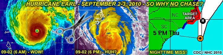
Why No EARL Chase? (9/2)

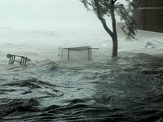
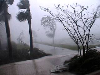
Hurricane Earl is passing to the east of the outer banks of North Carolina giving folks (and many chasers) there the WEAKER side of the storm (left side), a night-time event, and a weakening system due to shear (strong winds aloft). I was a go for this storm just a day ago, packed up and ready to head to North Carolina from south Florida.


The chase was cancelled at the last minute with both careful consideration and great deliberation. As good as the storm looked early on Thursday, September 2, increasing wind shear caused steady weakening of the system, as well as a jog OFF the coast (no landfall). Storm chasers there, even on Cape Hattaras, should only experience hurricane forced gusts (at best) and big waves, and in total darkness.

You can also check my area on tropical weather and any associated activity / chase plans by clicking the link for that area on my web site provided below.

http://www.sky-chaser.com/tropics.htm
Monday, August 30, 2010

Remembering Katrina (8/28)

August 28 marks the 5th anniversary of Hurricane Katrina in the Northern Gulf Coast in 2005. This storm was a devastating storm, with a record storm surge approaching thirty feet in height, that caused massive devastation and loss of life from New Orleans and eastward to Mobile, Alabama.


You can read more about Hurricane "Katrina" in 2005 and see a full chase log / story in the STORM CHASING section of this site. The link to this incredible chase log has also been provided at the link below.

http://www.sky-chaser.com/kat05.htm

US Protection? (8/26)

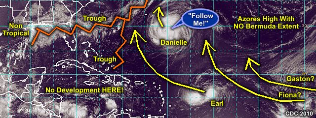
Tropical activity in the far Atlantic basin is picking up quite a bit as of late-August / early-September 2010, however, a persistant trough off the US East coast may deflect any intense activity out to sea for the time-being. Bermuda may offer some very remote chase prospects, but happens to be a very small (and unlucky) target if hit directly.


Right now, the US East coast will remain "vaccinated" from anything coming across the Atlantic. Intense hurricane Danielle and MOST storms behind it may actually follow the same path by recurving out to sea (hurricane chasers call these "fish storms". This pattern is good news for most people, but HORRIBLE news for hurricane chasers, who intercept / study tropical cyclones. But, it "is what it is".

You can also check my area on tropical weather and any associated activity / chase plans by clicking the link for that area on my web site provided below.

http://www.sky-chaser.com/tropics.htm
Remembering Charley (8/13)

Friday the 13th in 2010 marks the 6th anniversary of Hurricane Charley in Punta Gorda, Florida (2004). Hurricane names are re-used every 6 years for the Atlantic basin, unless a storm causes devastation and / or deaths. Hurricane "Charley" was a strong and devastating category 4 storm with 145-150 MPH sustained winds at landfall.


The name "Charley" has been retired and THIS (2010) year's replacement was "Colin", which occurred in early August as a weak and minimal tropical storm and was barely noticed by most. You can read more about Hurricane "Charley" in 2004 and see a full chase log / story in the STORM CHASING section of this site, or click the link to go right to it below.

http://www.sky-chaser.com/char04.htm

Saturday, July 31, 2010

Tropical Storm Bonnie (7/23)

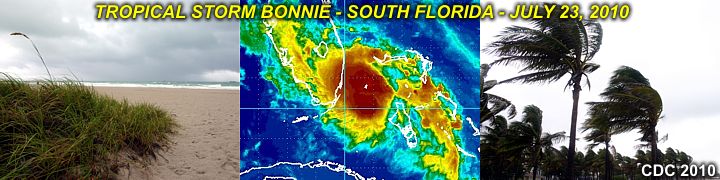
The tropics will continue to get more active as we move into late July and early August. As of July 23, tropical storm Bonnie has formed and hit south Florida as a weak tropical storm. The storm crossed Florida and weakened in the northern Gulf of Mexico a day later.


This system was also my first tropical cyclone intercept of 2010. A chase log for tropical storm Bonnie in July 2010 can be seen by clicking the link provided for it below.

http://www.sky-chaser.com/bonn10.htm

You can also check my area on tropical weather and any associated activity / chase plans by clicking the link for that area on my web site provided below.

http://www.sky-chaser.com/tropics.htm
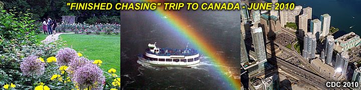
Canada Trip (6/20)

With storm chasing done as of the start of June 2010 and hurricane season for the Atlantic basin just around the corner, a trip to Canada was a great get away from Florida. I finished a great trip with a best friend of mine and visited the Niagara Falls / Toronto area for a few days.


You can check out details on my trips to Canada as well as MANY other places by clicking on the link provided below.

http://www.sky-chaser.com/outdoors.htm
Monday, June 14, 2010

Main Central US Chase (6/5)

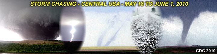
The third and MAIN storm chase trip to the central USA in 2010 (May 18 through June 1) is completed and a full chase log is finished and available. This trip also boasted some high-risk chasing as well as at least 20 (yes, TWENTY) tornadoes and numerous supercells, some with large hail and / or incredible storm structure.


You can also visit my chase logs for this main chase, as well as others in 2010, in my STORM CHASING area on my web site. The link to jump right to the are for this main chase trip for May 18 through June 1, 2010 is also provided below.

http://www.sky-chaser.com/mwcl2010.htm
Monday, May 17, 2010

Oklahoma Tornado Outbreak (5/15)

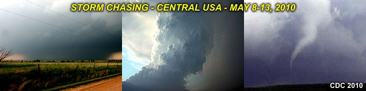
The second storm chase trip to the central USA in 2010 (May 8-13) is completed and a full chase log is finished and available. This trip boasted some high-risk chasing as well as several tornadoes and / or supercells, some with some incredible storm structure.


You can also visit my chase logs for 2010, which includes this event and others, in my STORM CHASING area on my web site. The link to jump right to the storm chasing area for 2010 is also provided below.

http://www.sky-chaser.com/mwcl2010.htm