Friday, November 23, 2012

Hurricane Sandy Effects (10/28)

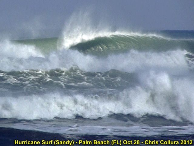
Hurricane Sandy was observed (indirectly) during its closest approach to the eastern coastal sections of the state of Florida as well. Some of the destructive marine effects were also observed from this storm. Sandy began as a tropical wave that entered the eastern Caribbean early during the week of October 22, 2012. The storm intensified to a tropical storm, then a hurricane, crossing Jamaica and eastern Cuba as a strong Category one hurricane. The storm passed through the eastern Bahamas as a category two storm before merging with an upper air low around October 25. This caused the hurricane to acquire subtropical characteristics, with a very wide wind field that expanded as the storm winds decreased to category one speeds while off the SE US coast.


The storm produced tropical storm forced winds in Florida during its closest approach, and battered the region with very high waves. The waves, surge, and winds continued to expand in coverage from October 28 onward, with the storm passing east of Cape Hattaras and making a left turn back to the NW as it became a 90 MPH extratropical storm just off New Jersey on October 29. The storm made landfall later that same day causing extensive flooding and wave damage to New England and the eastern Seaboard from Florida to Canada! The storm continued inland, as a post-tropical storm, and caused snow and blizzard conditions in West Virginia areas. Observations of this dangerous storm system were mainly coastal and fringe effects of the winds as it passed Florida. The chase / observation logs for Sandy are also available at the link below.

http://sky-chaser.com/sandy12.htm
Typhoon Sanba (9/15)

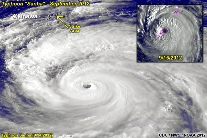
With the Atlantic and Eastern Pacific tropical seasons struggling to generate a strong hurricane, a different scenario of violence unfolds a half-a-world away in the Western Pacific with Typhoon "Samba". Formerly a category 5 storm, with 170+ MPH sustained winds (gusts over 205 MPH), the storm slammed ashore during the morning of September 15, 2012 on the small island of Okinawa.


Although far away, I know some storm chasers in that area who were there, mainly James Reynolds who lives in Hong Kong. As of the morning (local time), the eastern portion of Okinawa can be seen looking down through the vertical structure of the clear eye, and I can only wonder what anyone there saw (a "stadium effect"? Fog? No wind?) ... The storm came in at 120 MPH sustained winds - Very impressive indeed!

Hurricane Isaac (8/29)

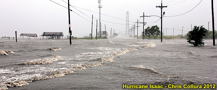
The image below shows Hurricane Isaac near Lake Ponchatrain just east of New Orleans, Louisiana during the morning of August 29, 2012. The storm caused an estimated 3 billion dollars in damages and at least 44 deaths as it travelled from the eastern Caribbean to the central United States. Maximum winds were up to 80 MPH as a hurricane in Louisiana.


The chase logs on Tropical Storm Isaac in the lower FL Keys on August 26 as well as Hurricane Isaac in the northern Gulf coastal states on August 28-29 are available in the TROPICAL section of the STORM CHASING page on my web site. You can also go right to the section on Isaac via the link for it below.

http://sky-chaser.com/isaac12.htm