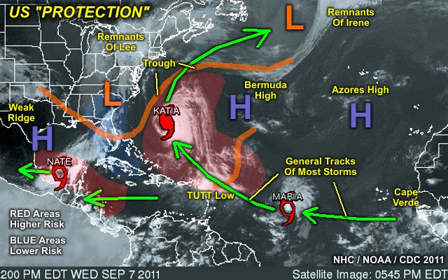
The graphic above shows the general weather pattern during the week of September 7, 2011. Note (in the graphic above) that despite quite a bit of activity in the Atlantic, the combination of a persistent trough off the US East coast as well as weak high-pressure ridging in the southern Gulf of Mexico, the southeastern and eastern US / northern Gulf regions are sort of in a "quiet zone" (blue area) and nestled in between regions of above-normal risk for tropical cyclones (red areas).
No comments:
Post a Comment