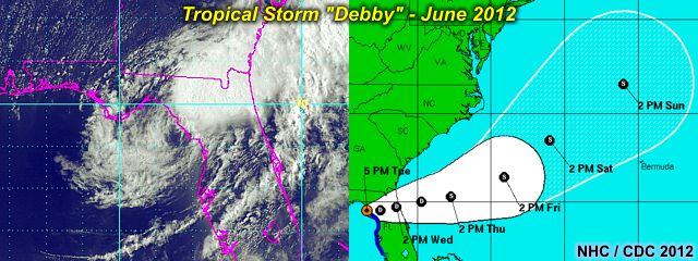
In the next image below, the storm can be seen as of June 26 as it was about to cross N Florida as a weak tropical storm / depression.
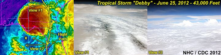
No intercept was done on the storm because of its weak structure. Debby caused severe flooding in Northern Florida, as well as some tornadoes on June 24 in other parts of the state. 2012 has got off to an extremely busy start, with four named storms before the end of June! Keep track of any tropical systems and hurricanes (and plans to chase them) with via the link for it below.
http://www.sky-chaser.com/tropics.htm
No comments:
Post a Comment