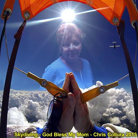
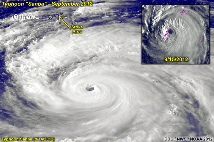
My mother, Geraldine Collura, has passed away on Thursday Night, September 12, 2013 at 11:26 PM EDT at age 71. Since early June 2010, she fought lung cancer that spread to her brain, causing seizures. She refused any chemotherapy - And radiation / surgery earned her nearly three and a half years of quality time on this planet. During the week of September 1, 2013 she needed chemotherapy as some of the cancer came back. That was the last weekend (after skydiving) when I hugged her and felt a feeling that told me something bad was going to happen ... Leaving in tears. She got a cold later on the following week, and shortly after, on September 6 (that Friday) was in the hospital (North Broward Medical Center in Pompano Beach, FL) with a pneumonia. On Saturday, she slid into a rapid descent with her health, entering a coma and her vitals completely shutting down, starting with the kidneys.
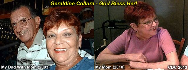
The last words she said was "mom..." (my grandmother). She continued on on life support and had no responses to anything in terms of improvement. Late on Thursday, September 12, she was removed from life support and brought into hospice where she passed away rather quickly, and peacefully, at 11:26 PM local time. This was very difficult - She was the closest person in my life EVER - And now she's gone. I guess God has her in his hands now... I will miss her so much. A memorial web page will be constructed for her as well soon.