Thursday, July 12, 2018

Spring Chasing 2018 Completed (7/8)

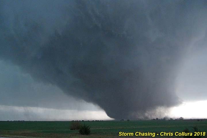
I have been storm chasing on and off in the central USA in 2018 from April 28 onward until June 25, with a return to Florida on July 8. The first powerful tornado, shown below, was captured on May 1, 2018 near Tescott, Kansas. Please check out my special section on this trip in the STORM CHASING section of this website under storm chases for MIDWEST 2018.


You can also click the link below to jump right to the section for storm chasing in 2018 in the central USA...

http://www.sky-chaser.com/mwcl2018.htm

First Storm Chase In N Alabama (3/19)

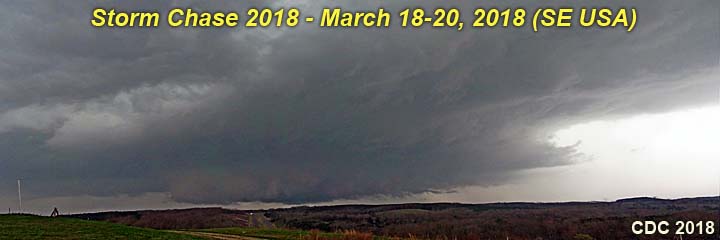
Storm chasing has begun in 2018 and the first chase of 2018 was done from March 18 to 20, 2018. This marks the start of the 2018 chase season logs for this web-site in the Midwest / Central USA. Please check my chase logs in the STORM CHASING section of this web-site under MIDWEST 2018 for this and many more chases in 2018.


You can also click the link below to jump right to the section for this chase as well as other storm chasing in 2018 in the central USA...

http://www.sky-chaser.com/mwcl2018.htm

Storm Chaser Convention (2/18)

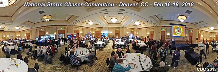
The storm chaser convention in 2018 took place from February 16th through the 18th in Denver, Colorado at the Hilton Doubletree off Quebec Street and just south of I-70. Thanks to the great efforts of Roger Hill and his group for organizing this great event every year!


Click the link below to go right to the section for STORM CHASING EVENTS in 2018.

http://www.sky-chaser.com/picnic18.htm

Happy New Year 2018 (1/1/2018)

The New Year of 2018 is upon us! 2017 was a great year for storm and hurricane chasing and plans are in the works for 2018.


I wish everyone a happy an safe holiday season and propsperous New Year of 2018.

Thursday, October 12, 2017

Hurricane "Nate" Chase (10/7)

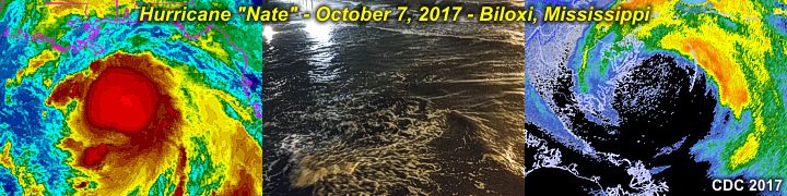
The seemingly relentless Atlantic hurricane season dished out yet another storm, Hurricane Nate, that affected Central America on October 5 and Louisiana / Mississippi on October 7. The landfall of this strong category 1 storm was documented near Biloxi, Mississippi late on October 7. This was the fourth hurricane interception in less than 2 months. This area is in the STORM CHASING section of this website under HURRICANE NATE 2017.


You can also jump right to that area by clicking the link provided below...

http://www.sky-chaser.com/nate17.htm

Hurricane "Maria" Chase In PR (9/20)

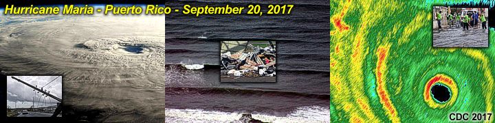
Hurricane Maria was yet another devastating hurricane that tore across the NE Caribbean, Puerto Rico, and the southeastern Bahamas. I was in Puerto Rico documenting this extreme hurricane disaster from September 19 through 24. This was my third major hurricane chase in less than a month! Hurricane Maria struck Puerto Rico on September 20 with sustained windspeeds the border of category 4 / 5 as it made landfall in the southeastern side of the island! This area is available in the STORM CHASING section of this website under HURRICANE MARIA 2017.


You can also jump right to that area by clicking the link provided below...

http://www.sky-chaser.com/maria17.htm

Hurricane "Irma" Chase (9/10)

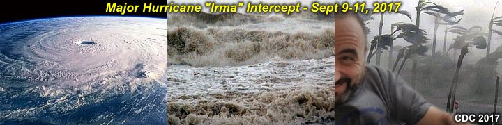
Hurricane Irma was a devastating and powerful hurricane that rampaged from the NE Caribbean, through Cuba, the Florida Keys, and finally Marco Island in SW Florida. I was there for this daytime interception of a major hurricane right at the border of category 3 / 4 intensity as it made landfall in Collier County, Florida on September 10! This area can be seen in the STORM CHASING section of this website under HURRICANE IRMA 2017.


You can also jump right to that area by clicking the link provided below...

http://www.sky-chaser.com/irma17.htm

Hurricane "Harvey" Chase (8/26)

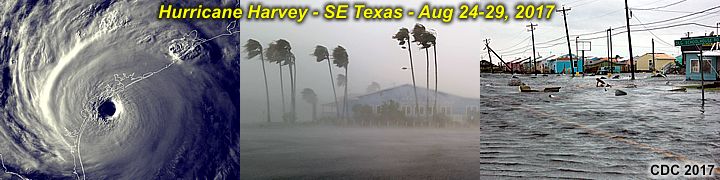
Hurricane Harvey was a powerful category 4 storm that hit southeastern Texas on August 25-26, 2017 and continued to wreck legendary damage and flooding on that state up until August 30 (with devastating flood in Houston). I was there for this storm and did extensive documentation on it from August 24th through the 28th!


You can also jump right to that area by clicking the link provided below...

http://www.sky-chaser.com/harvey17.htm

Great American Solar Eclipse (8/21)

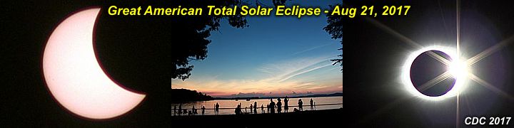
The long awaited solar eclipse of 2017 on August 21, 2017 was well documented and with beautiful weather in a campground near Spring City in Tennessee via a special trip. Please check out my special section on this trip in the STORM CHASING section of this website under storm chases for MIDWEST 2017 and look under the section in there for the eclipse.


You can also click the link below to jump right to the section for the 2017 eclipse...

http://www.sky-chaser.com/mwcl2017.htm

Spring Chasing 2017 Completed (6/26)

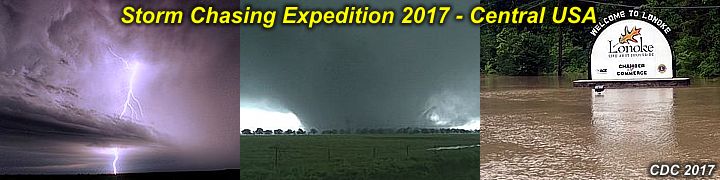
Storm chasing for the Spring of 2017 (including the main "expedition" trip) in the central USA has been completed. First trip was in late March of 2017, followed by the main trip on and off starting April 17 and ending June 26. Please check out my special section on this trip in the STORM CHASING section of this website under storm chases for MIDWEST 2017.


You can also click the link below to jump right to the section for storm chasing in 2017 in the central USA...

http://www.sky-chaser.com/mwcl2017.htm

Chase Season Begins (3/30)

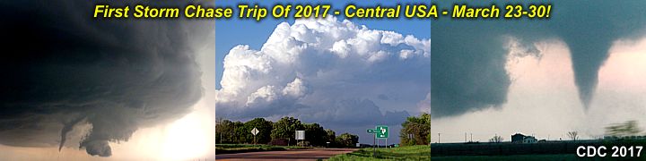
The storm chase season has kicked off for 2017. My first chase was a multi-day severe weather setup and chase in the central USA (mainly Texas and Oklahoma) from March 23rd to the 30th - With a pattern more liking to late spring! A new chase log is available for this in the STORM CHASING section of this website under storm chases for MIDWEST 2017.


You can also click the link below to jump right to the section for storm chasing in 2017 in the central USA...

http://www.sky-chaser.com/mwcl2017.htm

Chasercon 2017 (2/19/2017)

The storm chaser convention (or "ChaserCon") in 2017 took place from February 17th through the 19th in Denver, Colorado at the Hilton Doubletree near Stapleton, and continues to be a great event each year. I did not attend this in 2016 (when it was in Oklahoma City in late January) since I was unable to make it out that time.


You can also jump right to that area by clicking the link provided below.

http://www.sky-chaser.com/picnic17.htm

Thursday, December 08, 2016

Happy Holidays (12/8)

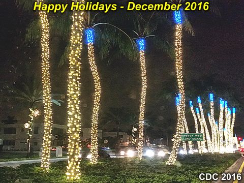
Wishing everyone a happy holiday and safe New Year! 2016 is wrapping up and it's been quite a year for storm chasing and traveling for me. As 2016 winds down, I am getting ready for what 2017 may bring.


In the meantime, I wish everyone a safe and happy holiday with friends and family.

Hurricane "Matthew" Chase (10/7)

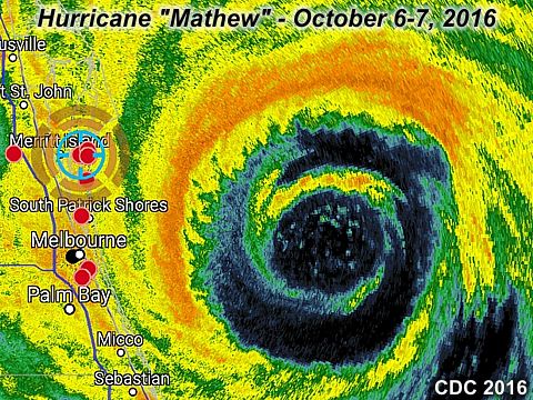
Hurricane Matthew was intercepted in the Cocoa Beach / Port Canaveral area from October 6 to October 7, 2016. A full chase log is being worked on for this chase! Be sure to check out the latest chase log on hurricane Matthew as well as any other tropical cyclone chases in my STORM CHASING section of this web site.


You can also jump right to that area by clicking the link provided below...

http://www.sky-chaser.com/matt16.htm

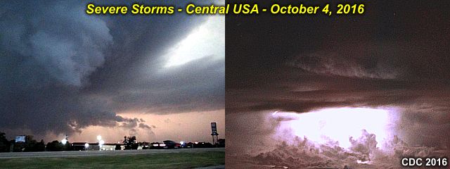
Supercells In Kansas (10/4)

A "spot" storm chase was done in Kansas from October 3 to October 5, 2016 in between a busy week, and before a chase of hurricane "Matthew"!


You can also click the link below to jump right to the section for storm chasing in 2016 in the central USA...

http://www.sky-chaser.com/mwcl2016.htm

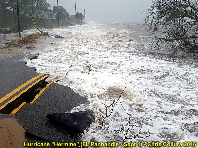
Hurricane "Hermine" Chase (9/2)

Hurricane Hermine was intercepted in the Florida Panhandle from August 31 through September 2, 2016. Be sure to check out the latest chase log on hurricane Hermine as well as any other tropical cyclone chases in my STORM CHASING section of this web site.


You can also jump right to that area by clicking the link provided below...

http://www.sky-chaser.com/her16.htm

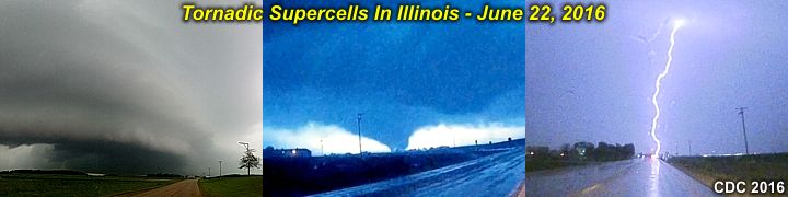
Tornadoes In Illinois (6/22)

A mini storm chase was done locally here in Illinois late in the day on June 22. At least two tornadoes were observed with HP supercells moving across north central Illinois around dusk. In the middle image in the graphic below, a large tornado is lightning illuminated near Seneca Illinois in Lasalle County after dark!


You can also click the link below to jump right to the section for storm chasing in 2016 in the central USA...

http://www.sky-chaser.com/mwcl2016.htm

Wednesday, June 08, 2016

Hurricane Season 2016 Begins (6/7)

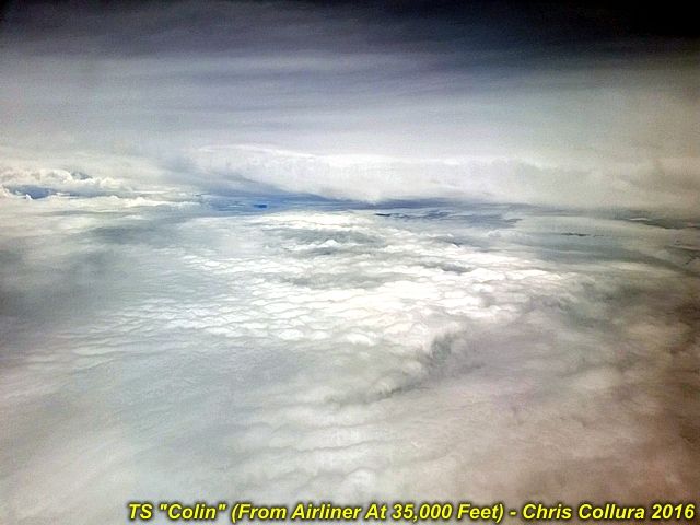
The tropical Atlantic is off to an early jump start with 3 named systems as of June 7, 2016 (with two before the official start of the season). Busy or not, always have a plan for these systems. In the image below, the view of the upper level (sheared) center of tropical storm Colin can be seen while overflying the storm between Fort Lauderdale, Florida to Chicago, Illinois aboard a Boeing 737 at an altitude of at least 35,000 feet during the late afternoon of June 6, 2016.


Be sure to check back my section on Atlantic TROPICAL WEATHER often to see what’s going on in the Atlantic / Eastern Pacific basin as well as any attempts on tropical chases in 2016! You can jump right to that section by clicking the link for it below...

http://www.sky-chaser.com/tropics.htm

Main Chase Trip On May 21-28 (5/30)

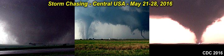
My main "expedition" style chase from May 21 through May 28 is completed - And was one of my best chase trips in my storm chasing career! A full chase log, with over 15 tornadoes documented, is now available in the STORM CHASING section of this web-site under MIDWEST 2016 for this and many more chases in 2016.


You can also click the link below to jump right to the section for storm chasing in 2016 in the central USA...

http://www.sky-chaser.com/mwcl2016.htm

OK Tornadic Violence / Chase May 6-9 (5/10)

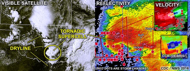
Just wrapped up yet another chase trip to the Central USA plains from May 6 to May 9, 2016. Tornadoes and supercells were observed on May 7 and 8 in Colorado and Kansas / Oklahoma! In the image below, both the visible satellite and radar image (base reflectivity) is shown for the violent tornadic supercell that occurred north of Sulphur, Oklahoma during the afternoon of May 9. I was NOT chasing this storm (unfortunately) because I had to head back to Chicago that day (travel day) for work the next morning.

The impressive radar presentation (right image) of this storm shows an extremely powerful mesocyclone (velocity is the upper-right inset, and correlation-coefficient in the lower-right inset - Prominently showing the grey-blue "debris" ball) as this storm was producing a potentially violent wedge tornado. The satellite image to the left shows the supercells in Oklahoma firing along the dryline (annotated), including the one in the radar images (circled). Impressive to say the least!


Please check my chase logs in the STORM CHASING section of this web-site under MIDWEST 2016 for this and many more chases in 2016. You can also click the link below to jump right to the section for storm chasing in 2016 in the central USA...

http://www.sky-chaser.com/mwcl2016.htm