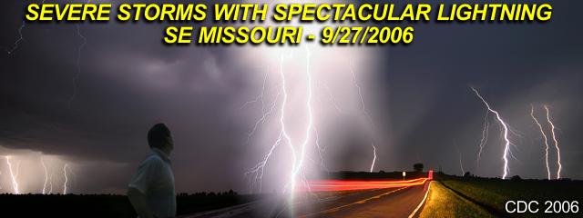
SUMMARY OF THE CHASE
September 27, 2006 was a chase day with severe thunderstorms intercepted in extreme southeastern Missouri and near the southern tip of Illinois, particularly in the areas near Cape Girardeau to Sikeston, Missouri near the Interstate 55 corridor. The chase began in the mid-afternoon leaving Creve Coeur, Missouri west of Saint Louis via Interstate 270, just missing rush-hour traffic. The primary target was pretty much the Cape Girardeau area itself, since while forecasting, a surface boundary (wind shift line) was draped across that area and was well ahead of an approaching cold front, currently over Saint Louis at the time and moving quickly southeast. This boundary also had an increase in moisture, with surface dewpoints nearing the low 60's south of it with SSW winds and upper 50's north of it with more westerly winds.
Also interesting, this surface boundary intersected the cold front to the west of the target area, creating a shallow "triple point". Temperatures in this area also re-bounded into the upper 70's by the afternoon, yielding a surface CAPE of about 1,500 to 2,000 J / Kg. Helicities were also highest in this region, about 100 to 150, not terribly high, yielding an EHI of about 1.0 to 2.0, enough for supercells. Upper winds were moderate to strong, with roughly 40-50 Knots of bulk shear to 6 km (500 MB) and the exit of an H3 jet stream moving in farther up. The only negatives would be the lack of directional shear and the fast storm movements, so a plan for hail and severe winds were the agenda for chasing. At SPC, a slight was issued for the 16:30z outlook, with a 2% tornado probability, 30% hail, and 15% damaging wind. A mesoscale discussion (MD) and subsequent severe thunderstorm watch went up for the same target area.
The trip to the target area continued off I-270 then south on Interstate 55 to the Cape Girardeau area. The surface boundary, with a line of elevated cumulus was encountered about 15 miles to th NW of Cape Girardeau. A severe thunderstorm developed on this boundary and matured near Marble Hill in Bollinger County. This storm was intercepted at about 5:30 PM and followed across Cape Girardeau and across the Mississippi river into Illinois where it weakened near Mclure. Back west, another storm developed near Poplar Bluff, so I headed back west into Cape Girardeau then south on Interstate 55 and got off at Benton, MO where the storm was just southwest of me. This storm became a prolific lightning producer. The storm weakened by about 7:30 PM as it passed near and to the east of Sikeston, MO. Both storms were HP supercell / multicell cluster in nature, and both produced severe winds and hail. No tornadoes were observed, but some small funnels were noted. The chase finished with a drive pretty much back north on I-55 into Saint Louis, then back to Creve Coeur on I-270.
The full chase log and details can be found at the link below...
http://www.sky-chaser.com/mwcl2006.htm
No comments:
Post a Comment